Children's Illustrated World Atlas
144
Pagini
2024
An
Hardcover
Copertă
Descriere
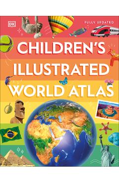
From Bolivia's bustling markets to the massive and scorching Sahara Desert, see the world with this beautifully illustrated atlas. Children's Illustrated World Atlas is divided into six main sections, each devoted to a continent. Within each continent, a country or a region is explored in detail thr...
From Bolivia's bustling markets to the massive and scorching Sahara Desert, see the world with this beautifully illustrated atlas. Children's Illustrated World Atlas is divided into six main sections, each devoted to a continent. Within each continent, a country or a region is explored in detail through stunning maps showcasing cities, towns, rivers, mountain ranges, and other geographical features. Apart from the geography of a region, Children's Illustrated World Atlas also provides interesting information about the people, their traditions, politics, and economics through spectacular images and snippets of facts. Take a trip around the world with Children's Illustrated World Atlas, from the majestic Himalayas to the Carnival of Venice. This colorful and comprehensive book is the perfect addition to every book shelf at home or school.
Take young readers on the ultimate round-the-world trip with this impressive atlas - packed full of beautiful illustrations and photographs.
Discover the world map-by-map with this exciting world atlas book for children, featuring more than 50 maps! Each page is filled with fascinating information, facts and colorful illustrations of our world. Children aged 9-12 will love to learn all about the many countries, cultures and people of the world through vibrant maps. Fascinating facts, local stories, vivid pictures, and clear, satellite-based maps together make this atlas a global yet personal experience for young readers. This illustrated atlas book for children offers:
- Bite-sized information giving the profiles, facts, stats and flags of every country.
- Pictures and stories explaining the society, culture and history of each region.
- Maps created using satellite imagery providing a clear view of the world map-by-map.
- A variety of topics covered, including population density, wealth, and internet access shown through graphics. From Bangkok's floating markets to the carnival in Venice, the Children's Illustrated World Atlas brings together views from windows all over the world. This illustrated atlas not only portrays regions, such as the Siberian wastes, with beautifully detailed maps but also describes the peoples who live there
Take young readers on the ultimate round-the-world trip with this impressive atlas - packed full of beautiful illustrations and photographs. Discover the world map-by-map with this exciting world atlas book for children, featuring more than 50 maps! Each page is f
Conectează-te pentru a lăsa o recenzie
Nicio recenzie încă
Ai citit cartea? Fii primul care lasă o recenzie!
Mai multe de Dk
Vezi toate
Pop Up Peekaboo! Penguin
Big Book of Bugs

My First Spanish Word Board Book/Mi Primer Libro de Palabras En Espanol: A Bilingual Word Book
DK First Picture Dictionary: Spanish: 2,000 Words to Get You Started in Spanish

Big Boys Use the Potty!
Mi Primer Libro del Cuerpo/My First Body Board Book
Baby Touch and Feel: Trucks

Baby Touch and Feel: Bedtime

Baby Touch and Feel: Animals

Baby Touch and Feel: Puppies and Kittens